
Rising 814m or 2,670 feet above sea level, Mweelrea is Connacht’s highest mountain. Its Irish name, “Cnoc Maol Réidh”, means “smooth bald hill”. Looking at the flat, curved and often snowy summit, its clear where the name comes from. Mweelrea is on the edge of Ireland surrounded by Doolough Valley to the north, Killary Harbor to the south, the 12 bens to the east and the wild Atlantic Ocean to the west.
The mountain seems to have its own microclimate. Mweelrea’s shape combined with how close it is to the Atlantic and its storm systems means that Ol’ baldy’s weather is very, very changeable. It also gets more than its fair share of snow.
There are three main routes to the summit: one from the Delphi valley, another ascending the famous ‘ramp’ from Doolough and a third route from the western coast.
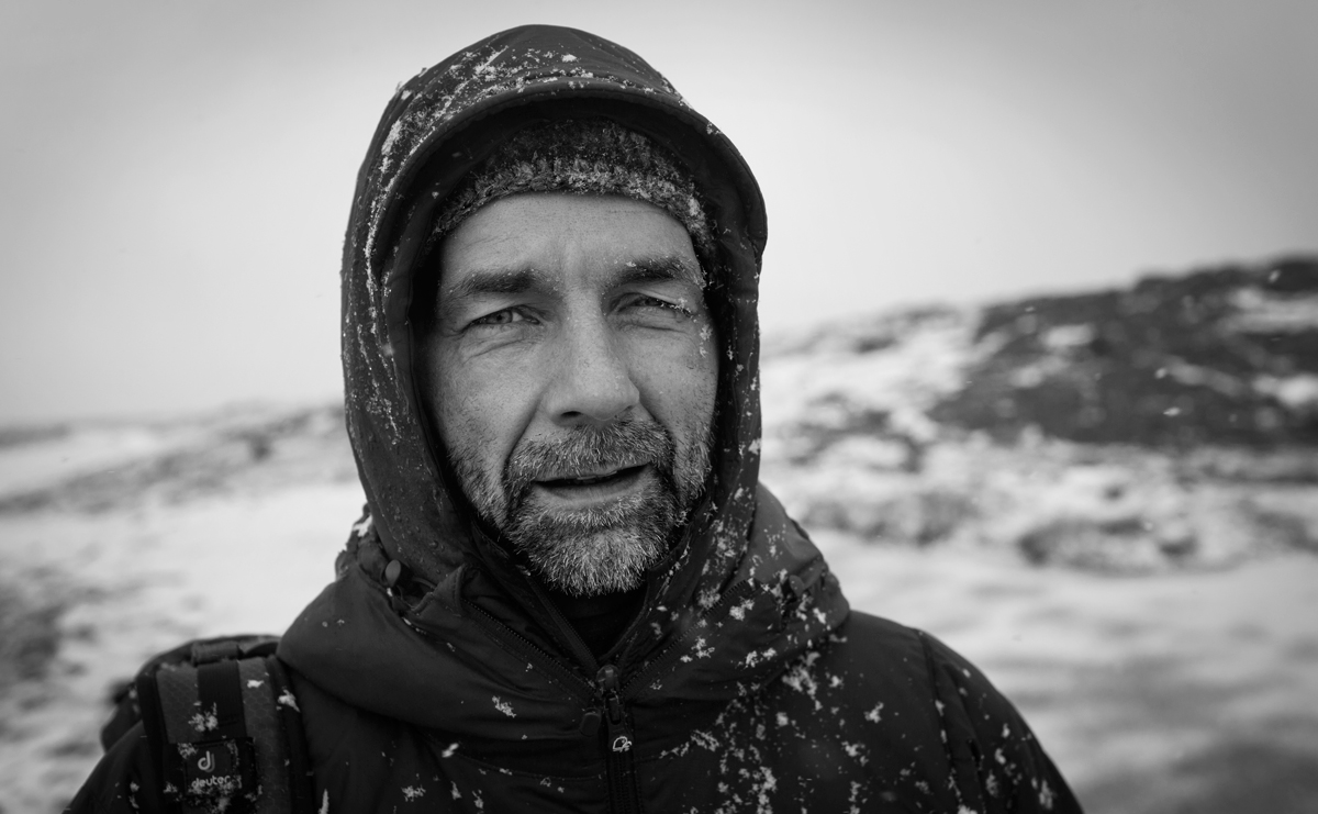
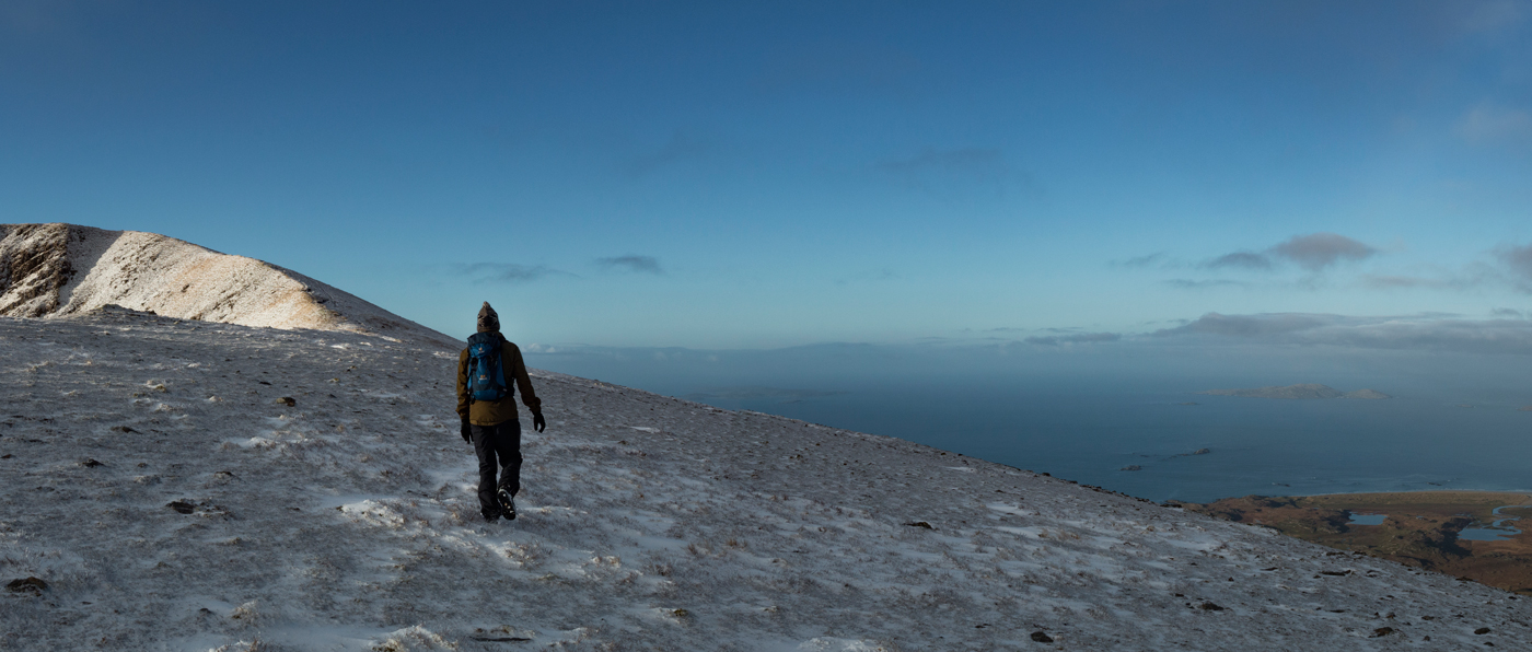
The ol’ man and I climbed Mweelrea from the west on a crisp morning at the very beginning of 2017. We were well prepared; good shoes, lots of layers, many maps and Dad had come equipped with a beard, which rivalled that of an Arctic explorer.
Our aim was to climb a good bit of the mountain before the sun rose so that we could get some nice pictures looking back down on the coastline as the sunrise turned the sky pink. Luckily, with the late winter sunrise, we didn’t have to get up too early. By 07:45 we had started walking.
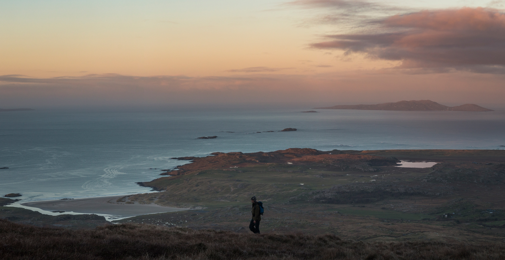
The first half of the climb is a slow ascent up towards the ridge. The only sounds were our (heavy) breathing, birdsong and the squelch of the wet bog beneath our feet. As we steadily climbed higher and higher the bog turned from wet to crunchy thanks to the frost. Soon all the pools of water were frozen. As we paused to admire the air bubbles in a frozen pond it began to snow. The snowflakes landed gently all around us and covered the icy ponds.
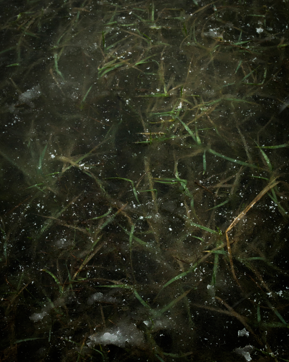
We brushed the layer of snow off the surface of one of the larger bog pools to reveal a beautiful pattern of frozen grass. Layer upon layer of frozen rich green grass made the pond feel as though it was endlessly deep.
We reached the main ridge about 40 minutes after the sun had risen so the light was still golden. There were sheer cliffs to the east with lough bellawaum a few hunder meters, almost directly, below us. The peaks of Ben Bury and Ben Lugmore were to our left and the flat, curved summit of ol’ baldy was on our right.
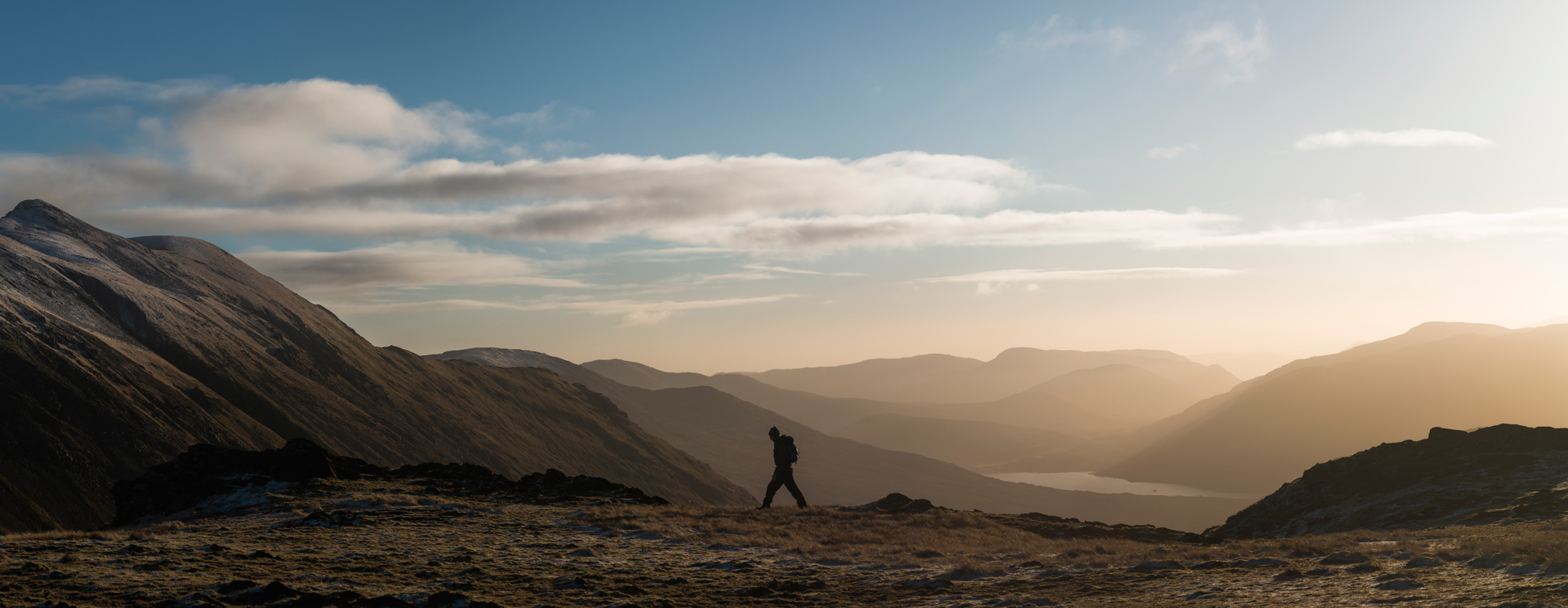
We had almost made the summit at this stage. All we had to do was follow the ridge south for another twenty minutes or so. As we walked along the ridge, on our left were the notorious Mweelrea cliffs and to our right was an icy slope that became steeper and steeper and eventually turned into more cliffs. Slipping on the ice wouldn’t have been ideal…
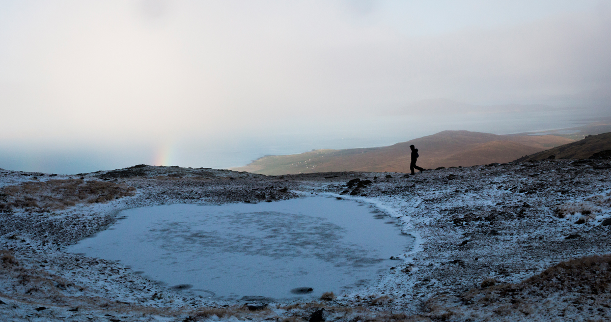
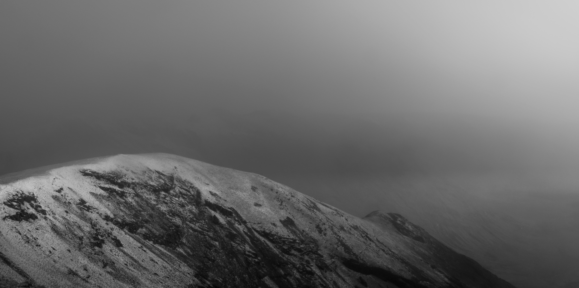
We reached the summit and took a quick breather. But, Mweelrea lived up to its reputation. Within three or four minutes the crisp, clear winter sky was covered up by dark storm clouds. The wind picked up and snow filled the air. The ridge began to fade away into the clouds and we quickly made our way down off the summit.
We retraced our footsteps in the snow back down the mountain, occasionally stopping for the odd photo. It was a great trip up ol’ baldy with the ol’ man. We’ll definitely be back.
* Snowbows are not actually real – this was, sadly, just a rainbow.
Prints of some of the photos from this trip are available here